
 562 628 1675

Consulting Services
ImageCat is globally known for providing solutions and consulting services in the following areas:
Disaster Risk Assessment, Modeling and Management
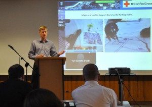
ImageCat’s engineers and scientists have many years of experience in performing natural hazard loss estimation studies. The principals are known internationally for their efforts in developing real-time loss estimation and risk assessment tools. Having served as principal investigators on numerous research contracts and grants, we have first-hand knowledge of the issues that government agencies face after devastating natural disasters.
We generally approach problems of natural hazard risk assessment by separating the analysis into four main components. The first component deals with an assessment of the likelihood and severity of the hazard. For most hazards, this requires establishing the proper metric for measuring hazard intensity and developing a hazard-frequency curve that specifies how likely the hazard will occur over some time period. The next component is a damage or fragility curve, allowing us to correlate damage levels to different levels of intensity. The third component is an exposure model, describing the number of buildings or the extent of the population exposed to the hazard — for many studies we use remote sensing technologies to create these models. Finally, the last component deals with how the previous components are linked together, producing output that decision-makers can use to form hazard mitigation policies and strategies.
Our engineers have developed seismic models for US risks as well as numerous web-GIS portals for clients. As Associate members we are currently working with the technical team of the OASIS Open Loss Modeling Framework to have more open access to our model solutions and software. Our preferred development cycle involves continuous consultation with the client throughout development — rapid prototyping and regular release of system features, followed by a feedback and reconfiguring session.
GIS and Remote Sensing
ImageCat is a worldwide leader in “fusing” remotely-sensed data with GIS technologies for the purpose of assessing risks from natural hazards. During the Haiti earthquake, for example, we collaborated with numerous satellite and airborne companies to provide high-resolution imagery to the World Bank/GFDRR in support of the Post-Disaster Needs Assessment, used to perform detailed building damage assessments of Port-au-Prince and surrounding areas.
One highlight of this analysis was the use of “crowd-sourcing” to engage over 600 experts from 23 countries in damage assessment — a first-of-a-kind initiative highlighted at the 2010 World Bank Understanding Risk conference. The distributed nature of crowd-sourcing has also been used for post-hurricane deployments on behalf of FEMA (2012 Hurricanes Isaac and Sandy).
ImageCat scientists led the Global Earthquake Model’s Risk Global Component, Inventory Data Capture Tools. In this three-year project, protocol documents were produced and thoroughly tested for open-source GIS and remote sensing data processing, focused on Quantum GIS/GRASS suites of software.
Open Data and Software
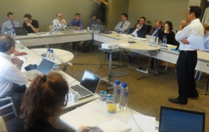
ImageCat supports and has been widely involved in many open data initiatives to date, including post-event damage databases and map products developed in collaboration with national governments and multi-lateral agencies (the 2010 Haiti and Chile earthquakes, 2011 Japan tsunami, 2012 US hurricanes, tornadoes and floods, 2013 Oklahoma tornado).
Open data access and sharing was the purpose of the Virtual Disaster Viewer platform founded by ImageCat, the Earthquake Engineering Research Institute (EERI) and the Multidisciplinary Centre for Earthquake Engineering Research (MCEER), allowing sharing of satellite imagery interpretations of damage alongside GPS-referenced in-situ field photographs.
Engineering Consulting Services
ImageCat provides engineering consulting services in:
- Structural review and earthquake risk assessment for individual buildings and portfolios
- Lifeline and utility vulnerability and risk from natural hazards
- Natural hazard and technological hazard exposure screening
Much of our consulting practice makes use of the SeismiCat seismic risk management system (seismicat.com).
Recent Projects – Recent seismic risk analysis projects have examined seaport wharfs and cranes (at the Port of Long Beach and Port of Seattle), airport and wharf facilities (Port of Portland), and a nationwide portfolio of rooftop and commercial photovoltaic panels. Previous projects have included new combined-cycle natural gas electric power stations in northern and southern California, and damage relationships for lifeline utility structures for combined earthquake shaking and tsunami inundation.
Solution Partners – ImageCat teams with a large number of engineering firms to provide flexible and innovative solutions to a wide range of natural and technological hazards. We recently inaugurated the earthquake Risk Solution Marketplace (seismicat.com/index/market) where building owners, lenders and insurers can find qualified Structural Engineers, Geotechnical Engineers and wind risk specialists.
An ASCE 41-13 Bridge to HAZUS Damage Models – ASCE 41-13 is the national standard for the seismic evaluation of existing buildings. ImageCat is developing a new system intended to adjust HAZUS building damage models to reflect the engineering findings from building evaluations using ASCE 41-13, giving Professional Engineers a tool for building seismic ratings and improved risk services.
Urban Risk – ImageCat is exploring new models of seismic risk in the dense urban core (toppingtower.com), where older tall buildings with poor earthquake systems present high risks in large earthquakes, and impacts to neighboring structures are considered in a complete 3D view of the urban core.
Robust Risk – ImageCat is developing a new “robust” model for seismic hazards, based on the 2014 USGS National Seismic Hazard Mapping Project models, preserving the epistemic uncertainties that can be obscured by the use of logic trees — offering a complete robust seismic risk solution when coupled with robust inventory and damage models.