Queensland Floods boundary shape
18 Jun 2014
 562 628 1675
  01483 400690
18 Jun 2014
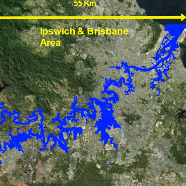
Flood boundary shapefile/KML polygon.
Date: 2011
Area: Flood peak footprint in GIS format for Brisbane, Ipswich, Toowomba, and Grantham
Data source: ecityrisk | ImageCat
Samples:
Sample PDF download (2.4mb)
Sample KML download (12kb)
Contact us to buy this dataset


Assess your full range of seismic risk and uncertainties with our SeismiCat model and Robust Simulation.
Find out more...