Katrina surge, wind and flood damage
18 Jun 2014
 562 628 1675
  01483 400690
18 Jun 2014
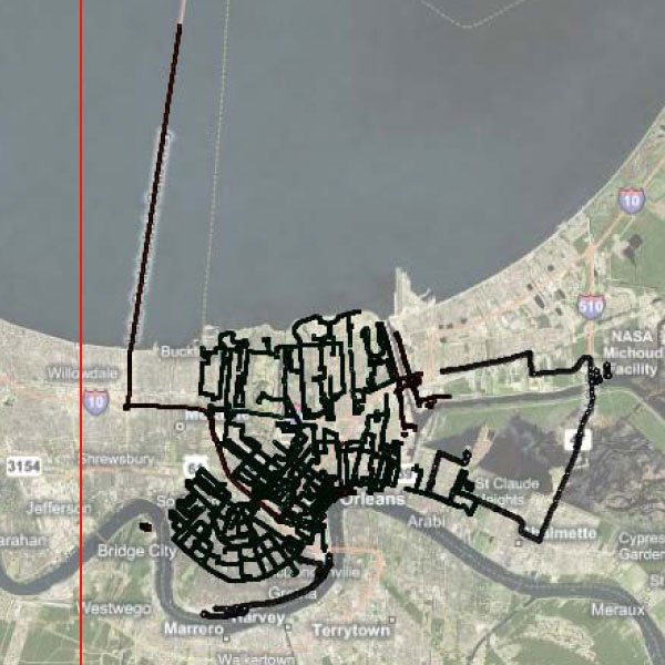
Surge, wind and flood damage. Street-level 38,000+ Hi def images and GPS-photo trail Shapefile/KML.
Date: 2005
Area: Mississippi coast: Waveland, Bay St. Louis, Gulfport, Biloxi, Ocean Springs, Gautier and Pascagoula; all residential, commericial, casinos, hotels, and industrial structures along the collection route. New Orleans: Almost all major neighborhoods in the City of New Orleans were extensively covered including all levee breach locations, 9th ward, downtown, locations along Lake Ponchartrain. Footage includes more than 50% of all major roads in the city
Data source: ecityrisk | ImageCat
Samples:
Sample PDF download (315kb)
Sample JPGs download (8.8kb)
Contact us to buy this dataset


Assess your full range of seismic risk and uncertainties with our SeismiCat model and Robust Simulation.
Find out more...