Christchurch earthquake street view
18 Jun 2014
 562 628 1675
  01483 400690
18 Jun 2014
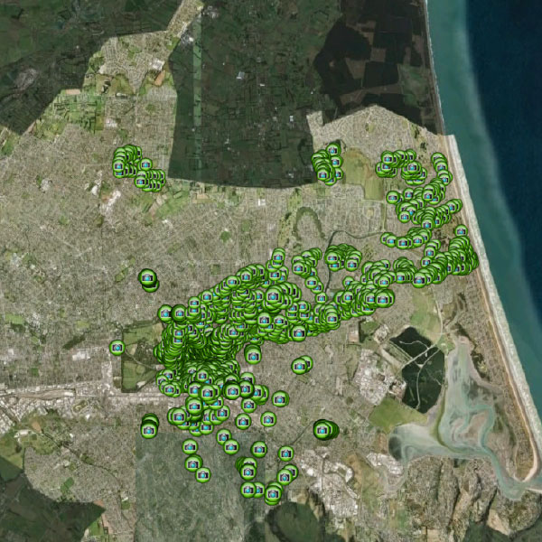
2000+ hi-definition GPS referenced oblique aerial and Street-view imagery in shapefile/KML.
Date: 2011
Area: Geocoded images showing damage to individual locations in Christchurch
Data source: ecityrisk | ImageCat
Samples:
Sample PDF download (4.4mb)
Sample KML download (4kb)
Contact us to buy this dataset


Assess your full range of seismic risk and uncertainties with our SeismiCat model and Robust Simulation.
Find out more...