Christchurch earthquake GIS footprints
18 Jun 2014
 562 628 1675
  01483 400690
18 Jun 2014
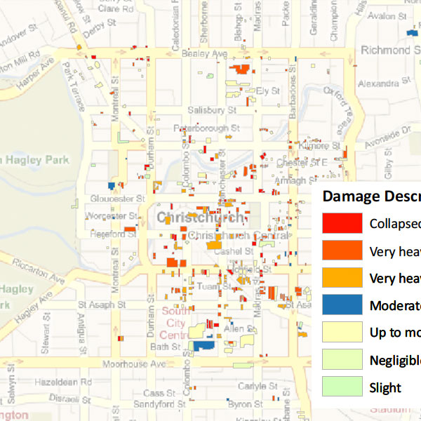
GIS footprints (for display in Google Earth or ArcGIS) containing attributes of address, occupancy, structural type and building height.
Date: 2011
Area: Per-building damage database (collapsed/severe and Moderate damage) for Commercial, Industrial and Residential LOB in Christchurch
Data source: ecityrisk | ImageCat
Sample PDF download (3.8mb)
Building damage sample KML file (4kb)
Contact us to buy this dataset


Assess your full range of seismic risk and uncertainties with our SeismiCat model and Robust Simulation.
Find out more...