France Floods
18 Jun 2014
 562 628 1675
  01483 400690
18 Jun 2014
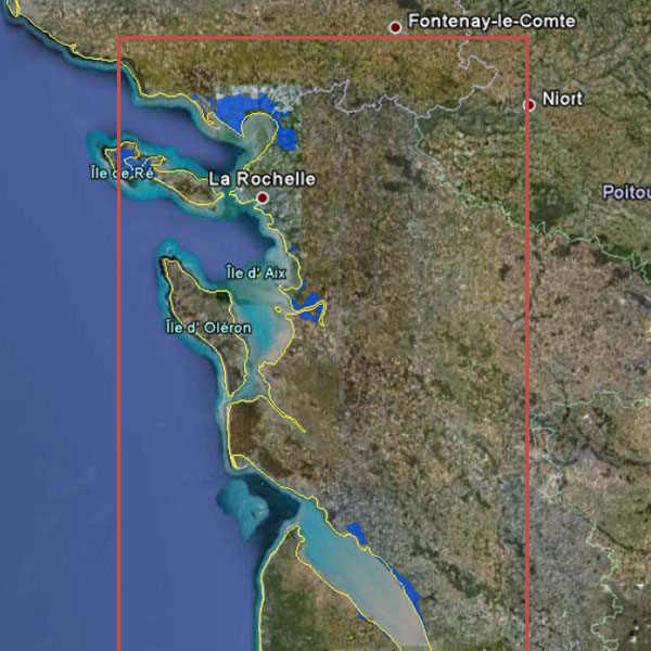
Flood boundary shapefile/KML polygon.
Date: 2010
Area: Flooded areas along the coast of North Western France including most affected areas in the Vendee and Charente Maritime covering over 100 miles of coastline. Major towns covered include Bourcefranc-le-Chapus, Port-des-barques, Fouras, Chanteillon-plage, Aytre, La Rochelle, Charron, l’Aiguillon-sur-mer, La Faute-sur-mer
Data source: ecityrisk | ImageCat
Samples:
Sample PDF download (139kb)
Sample KML download (25kb)
Contact us to buy this dataset


Assess your full range of seismic risk and uncertainties with our SeismiCat model and Robust Simulation.
Find out more...