Rita wind and flood damage
18 Jun 2014
 562 628 1675
  01483 400690
18 Jun 2014
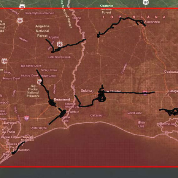
Wind and flood damage. Aerial 6000+ Hi def images and GPS-photo trail Shapefile/KML.
Date: 2005
Area: Communities covered St. Charles, St Mary, New Iberia, Galveston, Port Arthur, Groves, Beaumont; Approximately 5000+ buildings in various communities. Several (approximately 5) oil refineries around Beaumont and Port Arthur. Coverage includes residential, industrial and commercial structures, hotels and highways
Data source: ecityrisk | ImageCat
Samples:
Sample PDF download (160kb)
Sample JPGs download (3.1mb)
Contact us to buy this dataset


Assess your full range of seismic risk and uncertainties with our SeismiCat model and Robust Simulation.
Find out more...