 562 628 1675
Research and Collaboration
Research and development is at the core of ImageCat’s activities. We have been awarded research grants from a wide range of US & European government agencies, research councils and non-governmental organisations. As Principal Investigators on many of these projects, we have been able to establish global collaborative consortia to tackle challenging problems in the field of disater risk management.
- National Science Foundation (NSF)
- National Oceanic and Atmospheric Administration (NOAA)
- National Aeronautics and Space Administration (NASA)
- Federal Highway Administration (FHWA)
- US Department of Transportation (US DoT)
- US Geological Survey (USGS)
- Federal Emergency Management Agency (FEMA)
- Department of Homeland Security (DHS)
- UK Technology Strategy Board
- UK Environmental and Physical Sciences Research Council
- European Commission (EC)
Research Awards
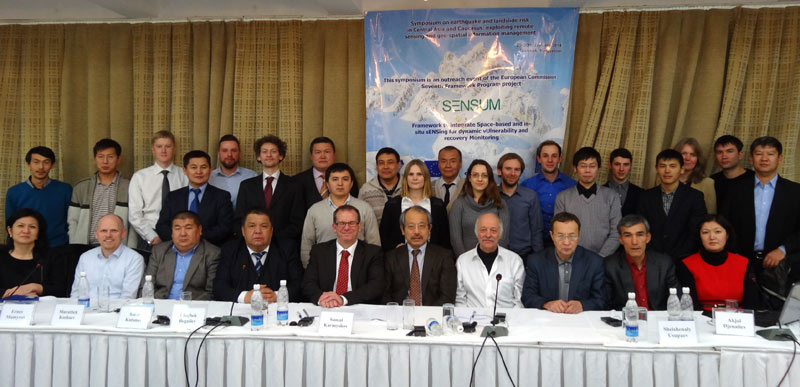
ImageCat are regular contributors to scientific literature and international conferences, e.g. the SENSUM Symposium on earthquake and landslide within Central Asia and Caucasus, Bishkek, Kyrgystan, 2014
Our grant awards have enabled ImageCat to develop cutting-edge technologies and solutions to many complex problems, in collaboration with the international scientific community. Our grant awards come from a wide variety of sources, yet the comon theme is the ability to deliver applied solutions, working in close partnership with key stakeholders. For example, one study performed for FEMA focused on assessing the efficacy of hazard mitigation projects sponsored by FEMA. Using a multi-variable index, this cost/benefit study found that “a dollar spent on hazard mitigation saves the nation about $4 in future benefits.”
Remote Sensing and Geospatial Data
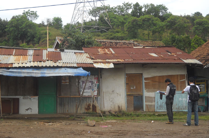
Exposure Data Development in Indonesia, 2011
A number of studies have focused on the use of remote sensing and geospatial data for measuring, monitoring and evaluating post-event recovery. These are significant studies and our project teams have been able to identify metrics for assessing relative speed and efficacy of recovery in communities affected by disasters. Without such a methodology, it is difficult to assess the effectiveness of rebuilding or reconstruction funds that invested by government agencies or relief organizations.
Team and Technologies
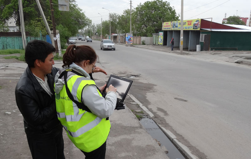
Senior Research Scientist, Enrica Verrucci directing testing of GEM Inventory Data Capture Tools, Bishkek, Kyrgyzstan, 2013
Through various projects we have worked hard to break existing barriers with respect to the use of new and emerging technologies. Our efforts to bring remote sensing to the forefront of natural hazard studies through close consultations with end-users are unprecedented. ImageCat initiated the Global Earth Observation Catastrophe Assessment Network (GEO-CAN) following the 2010 Haiti earthquake largely due to our wide network of scientific partnerships which have been demonstrated in practice for major disaster events since (i.e. 2012 Hurricane Sandy). We are internationally renowned for assembling large multi- and inter-disciplinary teams of experts to focus on complex problems in disaster management as evidenced for the Inventory Data Capture Tools global component for the Global Earthquake Model (GEM-IDCT). Our ability to form, organize and manage multi-institutional efforts is well-established in the scientific community.

