 562 628 1675
Post-event Data Catalog
ImageCat licenses ready-to-use disaster damage datasets, developed using evidence-based image analysis and field reconnaissance. These datasets cover real-world damage to buildings and infrastructure using aerial and satellite imagery, data mining and advanced geospatial field survey techniques.
Over 50 Historic Events
Our historic archive of damage data covers:
- Flood boundary
- Storm surge damage
- Hurricane wind damage
- Earthquake building damage
- Wildfire damage
- 2015 Nepal Earthquake, building damage, schools and hospital damage
- 2014 Napa Earthquake, critical infrastructure damage
- 2014 Serbia Floods, flood extent and building damage
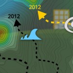
- 2012 Hurricane Sandy, USA, surge extent
- 2011 Thailand flood extent
- 2011 Tohoku, Japan, tsunami inundation boundary
- 2011 Christchurch, New Zealand, earthquake damage
- 2011 Genoa, Italy, flood extent
- 2010-11 Queensland, Australia, flood extent
- 2010 Xynthia, France, flood/surge inundation
- 2010 Madeira, Portugal, flood extent
- 2010 Haiti earthquake damage
- 2009 Cumbria, UK flood extent
- 2009 Georgia, USA, flood extent
- 2008 Hurricane Gustav, USA, surge extent
- 2008 Hurricane Ike, USA, surge extent
- 2007 California wildfires damage
- 2007 Yorkshire, UK, flood extent
- 2007 Gloucester, UK, flood extent
- 2005 Hurricane Katrina, USA, inundation
Global Coverage
Our damage datasets cover major catastrophes in US, Europe, established and emerging Asian insurance markets and selected humanitarian catastrophes (e.g. 2010 Haiti earthquake). Recent applications of our disaster data archive include understanding the past performance of high-value facilities such as refineries for making underwriting decisions. Our data has also been used to independently validate catastrophe model results, update vulnerability functions and event sets and provide expert witness following major catastrophic events.
These datasets are provided in GIS-ready shapefile and kml formats, suitable for immediate integration into existing business intelligence or GIS software platforms. Currently, these data are exclusively available through the inhance Data Market.

